I will write google earth engine, gee, code for your projects

S
sufyanullah03
S
sufyanullah03
Sufyan

Level 1

Certaines informations sont présentées en anglais.

À propos de ce service

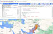
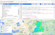
If you are looking for GIS Expert and Remote Sensing tasks Using Google Earth Engine this gig is for you.

I am a GIS Professional and Cartographer having a Master's degree in GIS and RS. I have 5+ years of experience in field and I love to solve/explain real-world phenomena with GIS Maps and Data Visualization. I can also help you with your research works.


My Services :


  • Geo Spatial Analysis
  • Land Use Land Cover Extraction
  • Time Series Analysis, Change Detection
  • Vector & Raster Maps
  • Thematic / Choropleth Map
  • Terrain Analysis & Modelling
  • Data Visualization (Density, Population, Ecological etc.)
  • Address Geocoding
  • Data Conversion ,Shapefile, Feature Class, Geodatabase, KML, Coordinate System, Projection etc.
  • Digitization + Georeferencing
  • Watershed & Viewshed Analysis
  • Multi-criteria decision analysis
  • Territory / Inventory Maps
  • Topographic Maps (contour, shaded relief)
  • Network, Cost-Path Analysis
  • Geo Database Designing and Management
  • Hydrology, Watershed
  • DEM, TIN, LiDAR (Only Freely Available)


Software I use:


  • ArcGIS Desktop, ArcGIS Pro, ArcMap, QGIS, Erdas Imagine, PCI Geomatica, Google Earth Engine, Google Earth Pro


 NOTE: Please contact me before placing orders.

Découvrez Sufyan

Sufyan

GIS and WebGIS Expert , Remote Sensing and Spatial Analysis

5,0(4)

Level 1

  • DePakistan
  • Membre depuismai 2022
  • Temps de réponse moy.1 heure
  • Dernière commande2 mois
  • Langues

    Ourdou, Anglais, Allemand
I am a professional GIS Specialist and WebGIS Developer with expertise in Geographic Information Systems, Remote Sensing, and interactive web mapping. Proficient in ArcGIS, ArcGIS Pro, QGIS, Google Earth Engine, Leaflet, Mapbox, and Python, I provide high-quality GIS mapping, spatial analysis, satellite image processing, land use classification, change detection, and custom WebGIS applications. I transform complex geospatial data into clear, actionable insights and interactive maps for businesses, researchers, and organizations.

Mon portfolio