Certaines informations sont présentées en anglais.
À propos de moi
Hello and welcome! 👋
I have 6 years of hands-on experience in GIS, Geology, and Mining, working on mapping, spatial analysis, and mine planning projects.
🗺️ GIS & Geospatial Services
✔ Georeferencing
✔ Raster & scanned map digitizing into clean vector data (points, lines, polygons)
✔ Google Earth / Google Maps data (KML format)
✔ Satellite imagery map
✔ Digital terrain modeling & analysis
✔ Geospatial database creation
✔ Data conversion (.gdb, .shp, .dwg, .kml, etc..)
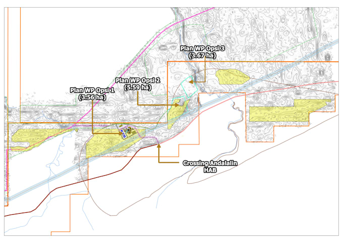
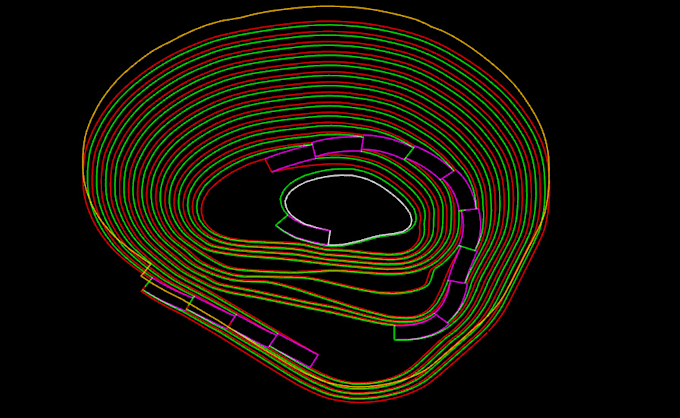
⛏️ Mining Engineering Services
✔ 3D Open Pit Design
✔ 3D Haul Road Design
✔ Reserve Estimation
✔ Pit Optimization... Plus d’infos