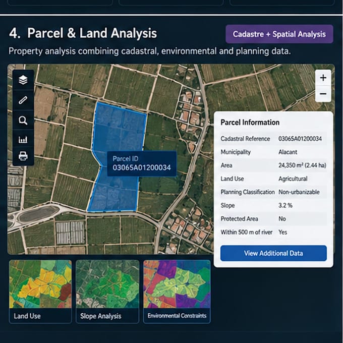
J'analyserai l'utilisation des parcelles et des terrains avec GIS

A
alexis_ba_
A
alexis_ba_
Alexis B
Certaines informations ont été traduites automatiquement.

À propos de ce service

Traduction automatique

Réalisation d'une analyse GIS au niveau des parcelles combinant des informations cadastrales, d'utilisation des sols, environnementales et d'urbanisme. La méthode permet d'évaluer chaque parcelle en fonction de sa localisation, de sa superficie, de son usage, des contraintes d'urbanisme et des conditions géographiques environnantes.

Découvrez Alexis B

Alexis B

GIS Analyst ArcGIS Python

  • DeEspagne
  • Membre depuissept. 2026
  • Langues

    Espagnol, Anglais
Hi! I'm Alexis, a GIS Analyst and Programmer specializing in ArcGIS and geospatial data workflows. I work with ArcGIS Pro, Enterprise, Python/ArcPy, SQL, Oracle, LiDAR and FME. I help clients automate GIS workflows, troubleshoot ArcGIS issues, manage geospatial databases, process LiDAR and satellite data, and build web GIS solutions. I focus on practical solutions, reliable results and clear communication. Feel free to contact me before ordering to discuss your project.

Traduction automatique

Mon portfolio

Balises associées