Parcourir les catégories
Français
$
USD
Connectez votre assistant IA à Fiverr


Traduction automatique
Besoin d'un travail SIG correctement réalisé dès la première fois ? Je suis chercheur en SIG et télédétection (chercheur PhD à l'Université de Tianjin, MSc de CUG Wuhan, 9 publications) avec une expérience professionnelle en SIG cadastrales. Je prends en charge toute tâche SIG de A à Z :
CARTOGRAPHIE : étude de zones et cartes de thèse, cartes thématiques, cartographie, mises en page, cartes web
DONNÉES : numérisation, géoréférencement, cartographie cadastrale/parcellaire, géodonnées, projections, nettoyage des données, conversion de formats (SHP, KML, GeoTIFF, CAD, CSV)
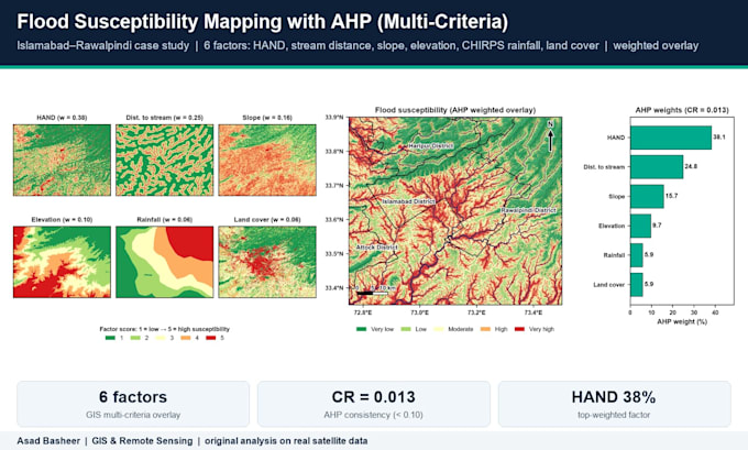
ANALYSE : aptitude du site (AHP/superposition pondérée), tampon/superposition, hotspots, interpolation (IDW, kriging), analyse réseau, statistiques zonales
TERRAIN & EAU : DEM, pente, délimitation des bassins versants, réseaux d’écoulement, zones de risque d’inondation
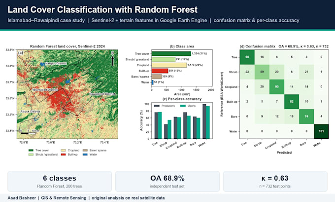
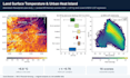
TÉLÉDOSÉENCIEL : NDVI/NDWI, classification LULC, détection de changement, température de surface, Google Earth Engine
AUTOMATISATION : Python (arcpy, GeoPandas, rasterio), ModelBuilder
Logiciels : ArcGIS Pro, QGIS, ENVI, SNAP, Google Earth Engine, Python
Chaque livrable comprend les fichiers sources et une courte note méthodologique. Étudiants, chercheurs, ONG et entreprises sont les bienvenus. Contactez-moi avec votre tâche avant de commander afin que je puisse confirmer le périmètre et le prix.
GIS and Remote Sensing Expert for InSAR and Google Earth Engine
Langues
Traduction automatique
Traduction automatique
Dois-je fournir les données ?
Pas nécessairement. Je peux utiliser des jeux de données libres tels que Landsat, Sentinel, DEM SRTM/ALOS, OpenStreetMap et les limites administratives. Si vous disposez de vos propres données, envoyez-les et je les utiliserai.
Allez-vous expliquer la méthode utilisée ?
Oui. Chaque livrable comprend une courte note méthodologique indiquant les sources de données, les outils et les étapes utilisées, afin que vous compreniez et puissiez reproduire les résultats.
Quels formats de fichiers livrez-vous ?
Tout format dont vous avez besoin : cartes PNG/JPG/PDF, shapefiles, GeoPackage, KML, GeoTIFF, CSV/Excel, ainsi que les fichiers de projet ArcGIS Pro (APRX) ou QGIS (QGZ).