Parcourir les catégories
Explorer
Fiverr Pro
Français
$
USD


Traduction automatique
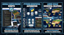
Vous recherchez un traitement d’images satellite performant, des pipelines spatiaux automatisés ou des scripts personnalisés pour Earth Engine dans le cloud ?
Je suis un analyste géospatial et data scientist expérimenté, spécialisé dans l’automatisation avec Google Earth Engine (GEE) et l’ingénierie de données spatiales en Python.
CE QUE CETTE SERVICE PROPOSE :
Scripts personnalisés GEE JavaScript / Python pour le traitement de données à grande échelle
Analyse de séries temporelles et dynamique de la végétation (NDVI, EVI, NDWI, SAVI)
Classification de l’utilisation des sols / couverture du sol (LULC) et apprentissage automatique (Forêt aléatoire)
Scripting GIS et automatisation par lots (GeoPandas, Rasterio, GDAL, ArcPy)
Détection de changements, cartographie des risques d’inondation et surveillance environnementale
Applications web interactives GEE et tableaux de bord personnalisés
SOURCES DE DONNÉES COUVERTES :
Sentinel-2 (MSI), Landsat 8/9 (OLI), MODIS, DEM SRTM, PlanetScope et jeux de données climatiques (CHIRPS, ERA5).
POURQUOI ME CHOISIR ?
Code propre, entièrement commenté et reproductible
Exécution rapide avec une précision technique rigoureuse
Support client dédié et communication claire
Veuillez me contacter avant de passer commande pour examiner votre zone d’intérêt (AOI), la portée du projet et vos besoins en données !
Remote Sensing Specialist, GEE Developer, and Agronomist
Langues
Traduction automatique


