Parcourir les catégories
Explorer
Fiverr Pro
Français
$
USD
Level 1
commande 1 en file d'attente
Traduction automatique
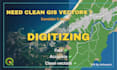
Bonjour et bienvenue sur mon service !
Vous avez besoin de couches GIS précises à partir de cartes ou d’images satellites ?
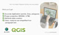
Je vais numériser vos éléments dans ArcGIS ou QGIS pour produire des données vectorielles propres et prêtes à l’emploi. Avec une expérience en GIS, télédétection et cartographie environnementale.
Services que je propose :
Ce que vous recevrez :
Pourquoi me choisir :
Je peux personnaliser des packages selon vos besoins. Veuillez me contacter avant de passer commande pour discuter de votre projet.
Au plaisir !
Ashwanie
GIS Specialist with a Background in Marine Sciences
Level 1
Langues
Traduction automatique


