Parcourir les catégories
Explorer
Fiverr Pro
Français
$
USD

Level 1

Traduction automatique
Bonjour et bienvenue sur mon service !
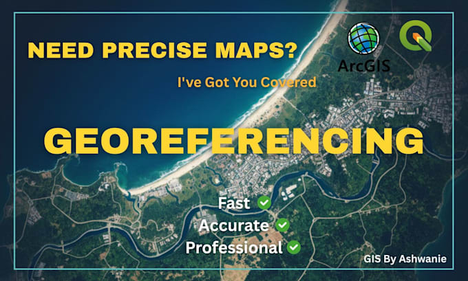
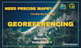
Vous avez besoin de géoréférencer vos cartes ou images satellites ?
Je vais aligner vos cartes scannées ou images raster avec les bonnes coordonnées en utilisant ArcGIS ou QGIS, en produisant des couches GIS prêtes à l’emploi. Avec une expérience en SIG et télédétection, je garantis des résultats précis et fiables.
Remise de groupe disponible !
Pour plus de 25 images, les tarifs réduits commencent à partir de 3,5 $ par fichier (moins de 6 GCP par image). Merci de me contacter avant de commander.
Services que je propose :
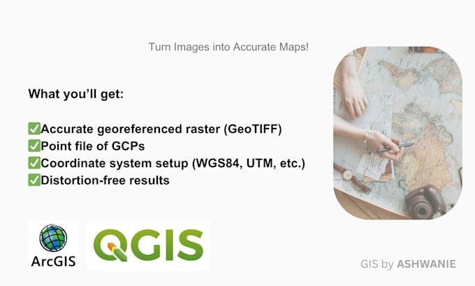
Ce que vous recevrez :
Pourquoi me choisir :
Des packages personnalisés sont disponibles. Merci de me contacter avant de passer commande.
Cordialement,
Ashwanie
GIS Specialist with a Background in Marine Sciences
Level 1
Langues
Traduction automatique
| (13) | ||
| (0) | ||
| (0) | ||
| (0) | ||
| (0) |
envi_experts
Client récurrent

Allemagne
Once again very reliable, helpful and professional work, including plan stitching and accurate georeferencing of historical and current site plans including plans that were difficult to locate and assign spatially.
100 $US-200 $US
Prix
8 jours
Durée

Réponse du freelance
envi_experts
Client récurrent
Allemagne
We requested an order for the georeferencing of more than 50 old planning documents at very short notice. The communication was fast and straightforward, and the delivery was completed without any issues two days before the very tight deadline. We would be happy to work with her again!
200 $US-400 $US
Prix
5 jours
Durée
Réponse du freelance
s3_nath

Inde
Miss is good at her work. Highly recommended!
Jusqu’à 50 $US
Prix
11 jours
Durée
Réponse du freelance
alfredojobke

France
very nice!
Jusqu’à 50 $US
Prix
2 jours
Durée
envi_experts
Client récurrent
Allemagne
We requested the georeferencing of 20 historical aerial images at short notice which she delivered very quickly and in high quality paired with clear and professional communication. We have no complaints and will gladly work with her again in the future.
100 $US-200 $US
Prix
3 jours
Durée
| (13) | ||
| (0) | ||
| (0) | ||
| (0) | ||
| (0) |
envi_experts
Client récurrent
Allemagne
Once again very reliable, helpful and professional work, including plan stitching and accurate georeferencing of historical and current site plans including plans that were difficult to locate and assign spatially.
100 $US-200 $US
Prix
8 jours
Durée
Réponse du freelance
envi_experts
Client récurrent
Allemagne
We requested an order for the georeferencing of more than 50 old planning documents at very short notice. The communication was fast and straightforward, and the delivery was completed without any issues two days before the very tight deadline. We would be happy to work with her again!
200 $US-400 $US
Prix
5 jours
Durée
Réponse du freelance
s3_nath
Inde
Miss is good at her work. Highly recommended!
Jusqu’à 50 $US
Prix
11 jours
Durée
Réponse du freelance
alfredojobke
France
very nice!
Jusqu’à 50 $US
Prix
2 jours
Durée
envi_experts
Client récurrent
Allemagne
We requested the georeferencing of 20 historical aerial images at short notice which she delivered very quickly and in high quality paired with clear and professional communication. We have no complaints and will gladly work with her again in the future.
100 $US-200 $US
Prix
3 jours
Durée