Parcourir les catégories
Français
$
USD
Connectez-vous à votre IA

Full Stack GIS Developer, Python, React, WebGIS, Drone, Remote Sensing, AI
Compétences
Voir mes services
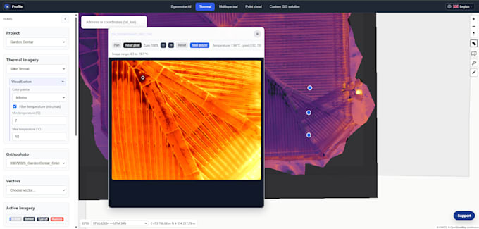
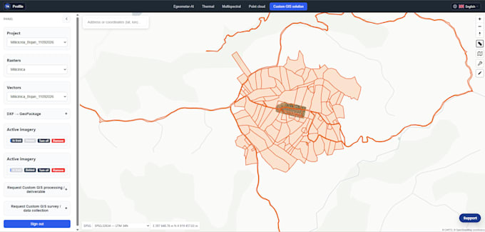
Full Stack GIS Developer
High Accuracy & GIS • Indépendant
Nov 2022 - Present • 4 yrs
1. WebGIS & Custom GIS Software Development - Interactive Map Applications: Development of custom WebGIS platforms using React, Python, and modern mapping libraries. - GeoServer & OGC Services: Setup, configuration, and optimization of WMS, WFS, and spatial data streaming. - Spatial Database Architecture: Designing, optimizing, and managing PostgreSQL/PostGIS databases for high performance and fast spatial queries. 2. Python GIS Automation & Data Pipelines - Workflow Automation: Writing Python scripts to automate repetitive geospatial tasks, batch processing, and data conversions. - Spatial Data Analysis: Advanced vector and raster data processing, spatial modeling, and custom geoprocessing tools. - API Integration: Connecting spatial databases with external APIs and third-party web services. 3. Drone Mapping, Photogrammetry & Remote Sensing - UAV Data Processing: Transforming drone imagery and aerial photographs into accurate orthomosaics, point clouds, and 3D models. - Thermal Drone Imaging: Infrared data analysis, thermal inspections, and professional thermal visualization reports. - Satellite & Aerial Imagery Analysis: Land cover classification, change detection, and raster analysis for various industries. 4. Cadastral & Geodetic Consulting - Spatial Data Management: Organizing, cleaning, and converting cadastral and surveying data into modern GIS formats. - Technical Consulting: Professional advisory and architectural guidance for complex geospatial, mapping, and surveying projects.

Geographic Information Systems Engineer
Connectbase • Freelance
Apr 2022 - Present • 4 yrs 7 mos
GIS Engineer in the Telecommunications Sector. Automation, DB Management, Spatial Analysis...
