Parcourir les catégories
Explorer
Fiverr Pro
Français
$
USD



Traduction automatique
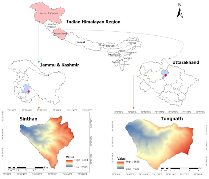
Je créerai des cartes GIS professionnelles et précises de votre zone d’étude en utilisant ArcGIS ou QGIS. Que ce soit pour des recherches, une thèse, des rapports ou des projets, je fournis des cartes de haute qualité.
Vous pouvez également obtenir des cartes thématiques telles que l’utilisation des terres / couverture du sol (LULC), l’altitude et l’aspect. Toutes les cartes sont modifiables et prêtes à être présentées, avec des options pour des diapositives supplémentaires ou des mises en page avancées.
Pourquoi me choisir :
Cartographie précise basée sur vos données ou coordonnées
Mise en page professionnelle adaptée à un usage académique et professionnel
Communication rapide et livraison dans les délais
N’hésitez pas à m’envoyer un message avant de commander pour discuter de vos besoins.
PhD in Spatial Informatics, Remote Sensing and GIS Specialist
Langues
Traduction automatique
Traduction automatique
Quel type de cartes pouvez-vous créer ?
Je peux créer des cartes de zone d’étude, des cartes de base, des cartes thématiques, des cartes LULC et des cartes basées sur des images satellites en utilisant ArcGIS ou QGIS.
De quelles informations avez-vous besoin de moi ?
J’ai besoin de la localisation de votre zone d’étude (coordonnées, shapefile ou nom), de toutes données spécifiques que vous souhaitez inclure, et de vos exigences pour la mise en page de la carte.
Pouvez-vous fournir des fichiers GIS modifiables ?
Oui ! Tous les packs peuvent inclure des fichiers GIS modifiables (comme .shp ou .qgis) si vous le demandez.
Puis-je obtenir la carte prête pour des présentations ou des rapports ?
Absolument ! Je fournis des cartes avec légendes appropriées, flèche du nord, barre d’échelle et images haute résolution adaptées aux présentations ou publications.