b
bashar_moh1

Bashar

@bashar_moh1

GIS and Remote Sensing Analyst, Mineral Exploration and Mapping

Arabie Saoudite
Arabe, Anglais
Certaines informations sont présentées en anglais.
À propos de moi
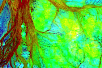
Independent GIS and remote sensing analyst based in Jordan, serving international clients since 2022. I turn satellite imagery into clear maps and exploration priorities using ArcGIS, QGIS and ENVI. Services: Sentinel-2/ASTER analysis, band ratios, PCA/MNF, terrain and structural interpretation, thematic mapping and technical reports in Arabic or English. Training includes NASA ARSET, Esri and EO College. Mineral exploration targets require field verification. Message me with your area, available data and required deliverables.... Plus d’infos

Compétences

b
bashar_moh1
Bashar
hors ligne • 
Temps de réponse moyen de 1 heure

Voir mes services

Système d'information géographique (SIG)
I will create gis maps and remote sensing mineral exploration reports
Système d'information géographique (SIG)
I will analyze satellite imagery for archaeological landscape screening

Portfolio

Expérience professionnelle

Self-Employed_/ Freelancer

Independent GIS & Remote Sensing Analyst

Self-Employed / Freelancer

Jan 2022 - Present • 4 yrs 9 mos

Deliver independent GIS and remote sensing projects for international clients, supporting mineral exploration screening, satellite imagery interpretation, thematic mapping and technical reporting. Use Sentinel-2 and ASTER imagery, band ratios, PCA/MNF, terrain and structural analysis, and geological/geophysical evidence integration. Deliver maps, spatial layers and reports in Arabic or English. Identify promising areas for field verification; remote sensing results do not confirm mineral deposits. Relevant training includes NASA ARSET, Esri, EO College, EO AFRICA, FutureLearn and GEO University.