Parcourir les catégories
Explorer
Fiverr Pro
Français
$
USD


Traduction automatique
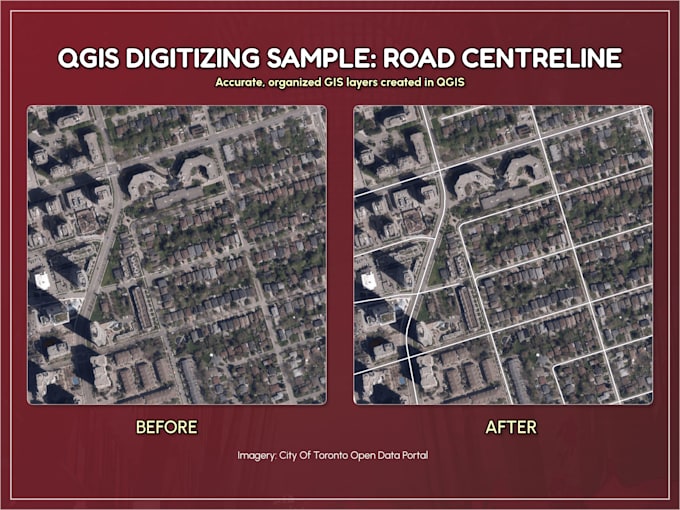
Convertissez des PDF, CAD ou cartes d’images en couches GIS propres et organisées.
Je numérise des points, lignes et polygones dans QGIS et fournis des fichiers structurés Shapefile, GeoJSON, KML ou GeoPackage prêts à être utilisés dans ArcGIS, QGIS, uMap ou Google Earth.
Fort de plus de 10 ans d’expérience en GIS, je privilégie une topologie propre, des attributs cohérents et une précision cartographique pratique.
Portée et complexité
Les forfaits incluent des fonctionnalités simples avec un nombre modéré de sommets. Les limites très détaillées (par exemple, lignes de contour, zones climatiques, régions basées sur le terrain, couches CAD denses ou dessins d’ingénierie irréguliers) nécessitent un devis personnalisé. Merci de me contacter avant de commander pour des cartes complexes.
La géoréférencement de PDFs scannés ou non spatiaux est disponible en option.
Les révisions couvrent de petites corrections des fonctionnalités initialement spécifiées. Les nouvelles fonctionnalités ou modifications de portée nécessitent une offre personnalisée.
Livrables :
Les résultats conviennent pour la cartographie et l’analyse générale (pas pour l’arpentage ou l’usage légal des limites).
GIS Analysis and Visualization
Langues
Traduction automatique
Traduction automatique
Qu'est-ce qu'une feature ?
Une feature est un point, une ligne ou un polygone simple avec une complexité modérée de sommets. Les formes très détaillées (par exemple, les lignes de contour, les régions de terrain, les couches CAD denses) peuvent nécessiter une offre personnalisée.
Faites-vous de la géoréférencement de PDFs scannés ou non spatiaux ?
Oui, en option. Veuillez confirmer si votre carte source est déjà géoréférencée avant de passer commande.
Qu'est-ce qui est inclus dans une révision ?
Les révisions concernent de petites corrections des features initialement spécifiées. Les nouvelles features ou l'élargissement du périmètre nécessitent une offre personnalisée.
Dois-je vous envoyer un message avant de commander ?
Oui, surtout pour les cartes complexes, les dessins d'ingénierie, les cartes de contour ou les grands ensembles de données. Un message rapide permet d'assurer un prix et un délai précis.
Cela convient-il à un usage légal ou d'arpentage ?
Non. Les livrables sont destinés uniquement à la cartographie et à l'analyse générale.
| (2) | ||
| (0) | ||
| (0) | ||
| (0) | ||
| (0) |
cottage_farm

États-Unis
Chris handled exceptionally well an assignment that involved overlaying present-day streets and property parcels on to a 1774 map of the same area. This involved combining his expert knowledge of GIS and data visualization with strong approaches to making the final product legible and attractive. All...
100 $US-200 $US
Prix
8 jours
Durée
nnijinsky

Canada
Cjhoorn did an outstanding job on my request. The work was precise, well-structured, and delivered on time, with excellent communication throughout. I highly recommend Cjhoorn for any GIS/KMZ mapping tasks.
50 $US
Prix
3 jours
Durée
| (2) | ||
| (0) | ||
| (0) | ||
| (0) | ||
| (0) |
cottage_farm
États-Unis
Chris handled exceptionally well an assignment that involved overlaying present-day streets and property parcels on to a 1774 map of the same area. This involved combining his expert knowledge of GIS and data visualization with strong approaches to making the final product legible and attractive. All...
100 $US-200 $US
Prix
8 jours
Durée
nnijinsky
Canada
Cjhoorn did an outstanding job on my request. The work was precise, well-structured, and delivered on time, with excellent communication throughout. I highly recommend Cjhoorn for any GIS/KMZ mapping tasks.
50 $US
Prix
3 jours
Durée