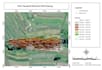
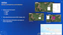
Je vais créer des cartes GIS professionnelles et des visualisations de données géospatiales

D
dapidddd
D
dapidddd
David B
Certaines informations ont été traduites automatiquement.

À propos de ce service

Traduction automatique

Je vais créer des cartes GIS professionnelles, effectuer des analyses spatiales et visualiser des données géospatiales en utilisant ArcGIS, QGIS et d’autres outils GIS. Je peux vous aider à transformer des données géographiques en cartes claires, précises et esthétiques pour vos projets.

Découvrez David B

David B

Senior Staff Operational

  • DeIndonésie
  • Membre depuismars 2026
  • Temps de réponse moy.1 heure
  • Langues

    Indonésien, Anglais
Master’s degree in Geomatic Engineering (ITS) with strong specialization in GIS and Remote Sensing Research and technical expertise in machine learning for geospatial analysis (XGBoost) Over four years of experience in GIS applications for infrastructure and environmental projects Advanced proficiency in ArcGIS, QGIS, geodatabase management, and spatial analysis tools Strong background in topographic surveying, data processing, and engineering integration A proven ability to collaborate with multidisciplinary teams and government institutions

Traduction automatique

Mon portfolio

Balises associées