e
elgaddari

El-gaddari

@elgaddari

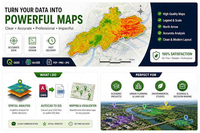
GIS Engineer QGIS, ArcGIS and Web Mapping Expert

France
Français, Anglais
Certaines informations sont présentées en anglais.
À propos de moi
I am a Geomatics and GIS Engineer specializing in GIS analysis, mapping, and spatial data solutions. I help clients transform raw geographic data into professional maps and decision-ready GIS workflows using QGIS, ArcGIS, QField, PostGIS, and web GIS technologies. Services: • GIS mapping & cartography • Spatial analysis • QGIS + QField workflows • Asset management systems • AutoCAD to GIS conversion • Georeferencing • Web GIS (OpenLayers / Leaflet) • Data visualization & reporting ... Plus d’infos

Compétences

e
elgaddari
El-gaddari
hors ligne • 
Temps de réponse moyen de 4 heures

Voir mes services

Système d'information géographique (SIG)
I will create professional gis maps and spatial analysis using qgis
Système d'information géographique (SIG)
I will create qgis, qfield and postgis gis asset management system

Expérience professionnelle

Freelance

Geomatics / GIS Engineer (Freelance)

Freelance • Freelance

Jan 2026 - Present6 mos

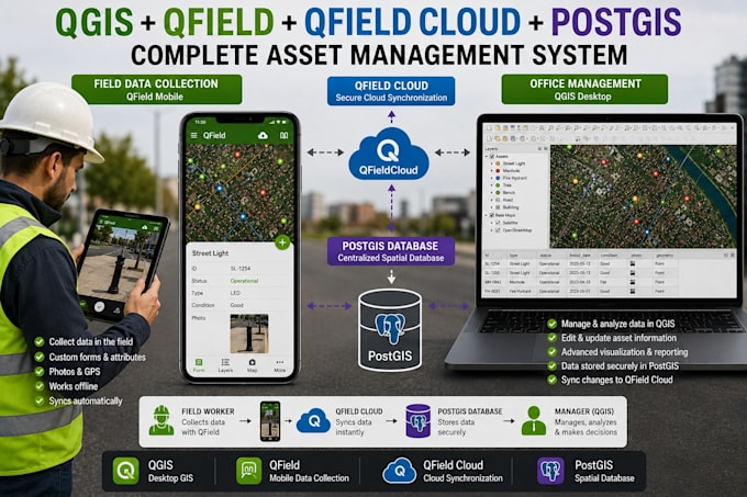
Worked on GIS projects including spatial analysis, cartography, georeferencing, and AutoCAD to GIS data conversion. Delivered professional maps and datasets for academic and technical use.