Parcourir les catégories
Français
$
USD
Connectez votre assistant IA à Fiverr

Compétences
Voir mes services

Civil Engineer
BAK • Temps plein
Sep 2025 - Present • 1 yr 2 mos
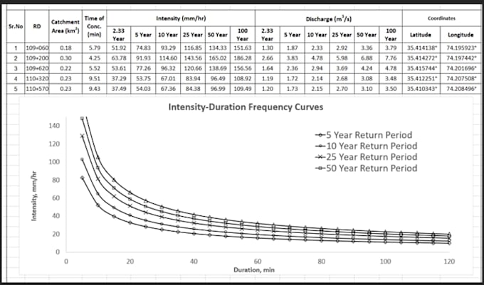
**Hydraulic Engineering | Flood Mapping | Hydrology | GIS** I am a Civil Engineer specializing in water resources engineering, hydrological analysis, hydraulic modeling, and GIS-based flood mapping. My services include: * **Hydraulic Modeling:** Open channel flow, water surface profiles, and hydraulic structure analysis using HEC-RAS. * **Flood Mapping:** Flood inundation mapping, floodplain delineation, and hazard maps. * **Hydrological Analysis:** Rainfall-runoff modeling, watershed analysis, peak discharge estimation, and flood frequency analysis using HEC-HMS. * **GIS Mapping:** Watershed delineation, DEM processing, drainage network extraction, catchment analysis, and thematic mapping using QGIS. * **Water Resources Engineering:** Hydrological calculations, technical reports, and engineering analysis for water-related projects. I focus on accurate analysis, professional-quality maps, clear documentation, and reliable deliverables tailored to your project requirements. Whether you need flood maps, watershed analysis, hydraulic modeling, or GIS-based water resources solutions, I am here to help turn your data into meaningful engineering results.
