Parcourir les catégories
Explorer
Fiverr Pro
Français
$
USD

Level 1



Traduction automatique
Je suis un expert titulaire d’un MSc en SIG avec plus de 20 ans d’expérience dans l’industrie, spécialisé dans les cartes de contour, les plans topographiques, la modélisation numérique de l’altitude et le levé topographique pour transformer des données de levé ou données SIG brutes en cartes de haute précision pour l’ingénierie, l’aménagement du territoire et le développement foncier.
Services proposés :
Caractéristiques à inclure dans le plan topographique :
Précision garantie.
Veuillez me contacter avant de passer commande !
Veuillez informer le freelance de toute préférence ou préoccupation concernant l'utilisation d'outils d'IA dans la réalisation et/ou la livraison de votre commande.
GIS Mapping, Drone Surveying, CAD Site Plans, 3D Modeling and Animations
Level 1
Langues
Traduction automatique
Traduction automatique
Qu'est-ce qui est inclus dans vos services d'arpentage et de plan topographique ?
Mes services couvrent une gamme de tâches, notamment le traitement des données de points d'arpentage, le traçage des données de divers instruments d'arpentage (station totale, GPS, DGPS, GNSS, balayage laser), la création d'enregistrements d'arpentage (ROS) pour les parcelles, les plans de site, etc. .
Qu’est-ce que l’arpentage ?
L'arpentage est la technique, la science et l'ingénierie permettant d'établir ou de rétablir des coins, des lignes, des limites et des monuments de biens immobiliers (terrains) sur la base de documents enregistrés, de preuves historiques et des normes de pratique actuelles.
Quels sont les types d’arpentage ?
1- Construction ou Ingénierie : étudie les changements dans les limites de propriété, l'emplacement des bâtiments, la topographie et le niveau des routes. 2- Géodésique : utilise l'imagerie satellitaire et aérienne pour mesurer de grandes parties de la terre. 3- Limite ou terrain : détermine où se trouvent correctement les lignes.
Quel matériel faut-il pour réaliser une étude foncière ?
L'arpentage des terres peut être effectué à l'aide de l'un des instruments/techniques suivants. 1- Station totale (X, Y, Z) 2- Système de positionnement global différentiel (DGPS) 3- Scanner laser 4- Imagerie satellite stéréo 5- Images de drone 6- Théodolite 7- Niveau (niveau de visée, niveau laser ou niveau d'eau)
Que sont les courbes de niveau et les cartes topographiques ?
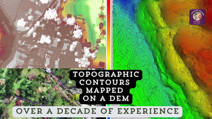
En termes simples, les courbes de niveau marquent des points d’égale altitude sur une carte. La topographie est l'étude des caractéristiques géographiques d'un paysage. Une carte comportant des courbes de niveau est appelée carte topographique. Essentiellement, les cartes topographiques représentent le paysage tridimensionnel de la Terre dans l'espace 2D d'une carte.
À quel niveau de détail puis-je m'attendre dans la carte de contour ?
Le niveau de détail de la carte de contour dépendra de la qualité et de la quantité des données des points de levé fournies. De manière générale, mon objectif est de produire des cartes de contour très détaillées et précises qui représentent fidèlement la topographie de la zone étudiée.
Pouvez-vous inclure des caractéristiques ou des annotations spécifiques dans la carte de contour ?
Oui, je peux inclure des caractéristiques ou des annotations supplémentaires telles que des routes, des bâtiments, des plans d'eau ou toute autre information pertinente sur demande. Faites-moi simplement part de vos besoins spécifiques et je ferai de mon mieux pour y répondre.
Comment le produit final sera-t-il livré ?
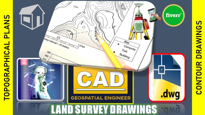
La carte de contour finale sera livrée au format AutoCAD (.dwg) ou carte JPG. D'autres formats de fichiers peuvent être disponibles sur demande.
Quel est le délai d'exécution habituel pour ce service ?
Le délai d'exécution varie en fonction de la taille et de la complexité de la zone à cartographier, ainsi que de la charge de travail actuelle. Je m'efforce de fournir des résultats de haute qualité dans un délai raisonnable et je vous fournirai une date de livraison estimée dès réception de votre commande.
Comment puis-je démarrer avec vos services ?
Pour commencer, veuillez me contacter avant de passer une commande. Cela nous permet de discuter des exigences de votre projet, de clarifier toutes vos questions ou préoccupations et de garantir que je peux vous fournir le meilleur service possible adapté à vos besoins.
| (15) | ||
| (1) | ||
| (0) | ||
| (0) | ||
| (0) |

lynntaylor

États-Unis
Thank you!!!!!!!!!!!!!!!!!!!!!
50 $US-100 $US
Prix
5 jours
Durée
ricmed372
États-Unis
Thank you. I appreciate the work.
100 $US-200 $US
Prix
5 jours
Durée
jasonwarner845

Costa Rica
Thank you once again.
50 $US
Prix
3 jours
Durée
jasonwarner845
Costa Rica
Highly responsive - highly professional output. I asked for a few edits and they came back better than I asked for. I will seek Geospatial out the next time I need similar services.
100 $US-200 $US
Prix
8 jours
Durée

amcodev

Canada
Delivered work as requested. Highly recommend.
50 $US-100 $US
Prix
8 jours
Durée
| (15) | ||
| (1) | ||
| (0) | ||
| (0) | ||
| (0) |
lynntaylor
États-Unis
Thank you!!!!!!!!!!!!!!!!!!!!!
50 $US-100 $US
Prix
5 jours
Durée
ricmed372
États-Unis
Thank you. I appreciate the work.
100 $US-200 $US
Prix
5 jours
Durée
jasonwarner845
Costa Rica
Thank you once again.
50 $US
Prix
3 jours
Durée
jasonwarner845
Costa Rica
Highly responsive - highly professional output. I asked for a few edits and they came back better than I asked for. I will seek Geospatial out the next time I need similar services.
100 $US-200 $US
Prix
8 jours
Durée
amcodev
Canada
Delivered work as requested. Highly recommend.
50 $US-100 $US
Prix
8 jours
Durée