Parcourir les catégories
Explorer
Fiverr Pro
Français
$
USD

Level 1


Traduction automatique
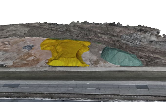
Je vais créer des orthomosaïques et des modèles 3D à partir d'images de drone
Transformez vos images de drone en cartes précises et en modèles 3D pour l'ingénierie et le levé topographique.
Orthomosaïques (géoréférencées)
Modèles 3D et nuages de points
DEM / DSM
Calculs de volume
Idéal pour les projets de construction, d'exploitation minière et d'aménagement du territoire.
Envoyez-moi vos images et détails du projet avant de commander.
Veuillez informer le freelance de toute préférence ou préoccupation concernant l'utilisation d'outils d'IA dans la réalisation et/ou la livraison de votre commande.
Topographic engineer
Level 1
Langues
Traduction automatique