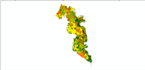
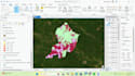
Je réaliserai une analyse spatiale, une cartographie gis, arcgis
H
H
Umar Hadi
Certaines informations ont été traduites automatiquement.
Plein écran
Plein écran
Plein écran
À propos de ce service
Traduction automatique
proposer des projets, notamment :
Numérisation de bâtiments
Numérisation de palmiers
Géoréférencement
Analyse de l'utilisation des terres
Aménagement
Température de surface terrestre
Zone tampon
Risque de catastrophe
Capacité des terres
Outil
ArcGIS
Découvrez Umar Hadi
Umar Hadi
GIS SPECIALIST AND URBAN PLANNER
DeIndonésie
Membre depuissept. 2021
Langues
Indonésien, Anglais
I have studied skills and knowledge relevant to Geographic Information Systems (GIS) and planning in college until graduating. The Regional and City Planning Study Program is no stranger to the world of mapping because it is related to the output of planning results. As a planner, I have learned how to prepare master plans, spatial pattern directions, land capacity units, spatial structures, field surveys, and so on.