Parcourir les catégories
Explorer
Fiverr Pro
Français
$
USD


Traduction automatique
Notre équipe est composée de professionnels issus d'instituts prestigieux tels que l'ISRO,
IIT, NIT, ICAR avec 2 à 3 ans d'expérience dans le domaine de la télédétection et des SIG. Leurs compétences variées et leur expérience contribuent au développement d'applications robustes utilisant Google Earth Engine.
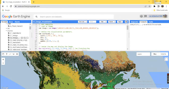
Nous proposons des services d'analyse d'images satellites pour des applications de télédétection et de SIG en utilisant l'API Javascript de Google Earth Engine. Nous aidons à construire des applications web de bout en bout avec GEE.
Spatial Data Scientist, GIS, Optical and SAR Satellite exploiter
Langues
Traduction automatique
Traduction automatique
Proposez-vous des services liés à l'API Python de Google Earth Engine ?
Oui, nous proposons. Veuillez nous contacter pour cela.
Proposez-vous d'autres services liés à l'analyse géospatiale non mentionnés dans le gig ?
Oui, nous proposons tous les services liés aux ressources en eau, à la foresterie, à l'agriculture, à l'urbanisme, à la marine, à l'atmosphère et aux catastrophes. N'hésitez pas à me contacter pour en savoir plus.
Proposez-vous des conseils pour des projets et devoirs universitaires ?
Oui, nous proposons des conseils et des services pour des projets et devoirs universitaires liés à l'analyse géospatiale.