Parcourir les catégories
Explorer
Fiverr Pro
Français
$
USD





Traduction automatique
Vous avez besoin d’un cartographie SIG, analyse spatiale ou télédétection précise ? Je transforme données spatiales et images satellites en cartes professionnelles, analyses fiables et résultats prêts à l’emploi.
Cartographie SIG & cartographie
Analyse spatiale
Télédétection
Outils
ArcGIS Pro, QGIS, Google Earth Engine, ERDAS IMAGINE et Python.
Vous recevez
Cartes PDF/PNG en haute résolution, fichiers GIS modifiables, données traitées, fichiers de projet et rapport, selon votre pack.
Pourquoi travailler avec moi ?
Veuillez m’envoyer un message avant de commander avec votre objectif, zone d’étude, données et résultat souhaité. Je vous recommanderai le pack adapté, le coût et le délai de livraison.
Full Stack GIS Developer : Web GIS, Remote Sensing and GeoAI
Langues
Traduction automatique
Traduction automatique
Quels services de cartographie GIS proposez-vous ?
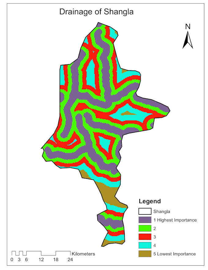
Je crée des cartes professionnelles thématiques, cadastrales, topographiques, environnementales et prêtes à publier en utilisant ArcGIS Pro et QGIS. Chaque carte peut inclure une symbologie personnalisée, des étiquettes, des légendes, des barres d’échelle, des coordonnées et votre branding souhaité.
Quels types d'analyses spatiales pouvez-vous réaliser ?
Je propose des analyses de buffer, superposition, proximité, hotspots, réseau, terrain, bassin versant, multi-critères et d’adéquation au site. Merci de partager votre objectif et vos données disponibles afin que je puisse recommander la méthode appropriée.
Quels services de télédétection offrez-vous ?
Je réalise des classifications d’usage des sols et de couverture terrestre, la détection de changements, l’analyse NDVI et de végétation, la cartographie de la croissance urbaine, le traitement d’images et l’analyse de séries temporelles satellite.
Quels outils GIS et de télédétection utilisez-vous ?
J’utilise ArcGIS Pro, QGIS, Google Earth Engine, ERDAS IMAGINE, Python, GDAL, GeoPandas et d’autres outils géospatiaux. Le logiciel sera choisi en fonction de vos données, analyses et livrables.
Quels formats de données pouvez-vous traiter ?
Je travaille avec Shapefile, GeoPackage, GeoJSON, KML/KMZ, CSV, Excel, File Geodatabase, GeoTIFF, DEM, données GPS, services WMS/WFS et autres formats GIS standards.
Dois-je fournir les données GIS ou les images satellite ?
Veuillez fournir vos données disponibles dans la mesure du possible. Je peux également identifier des données spatiales open source ou des images satellite adaptées. Les jeux de données commerciaux et les images payantes ne sont pas inclus sauf accord séparé.
Quels livrables vais-je recevoir ?
Selon votre forfait, vous pouvez recevoir des cartes PDF/PNG en haute résolution, des fichiers de projet ArcGIS ou QGIS modifiables, des jeux de données spatiales traités, des résultats d’analyse et un rapport succinct ou détaillé.
Pouvez-vous créer des cartes pour des articles de recherche, des rapports ou des présentations ?
Oui. Je réalise des cartes de qualité publication pour la recherche académique, les rapports techniques, les études environnementales, les documents de planification et les présentations, selon les dimensions et normes de format requises.
Qu'est-ce qui est inclus dans une révision ?
Une révision couvre des ajustements raisonnables dans le cadre de la portée initiale, comme les étiquettes, les couleurs, la mise en page ou la présentation. De nouveaux jeux de données, analyses, zones d’étude ou livrables peuvent entraîner des frais supplémentaires.
Dois-je vous contacter avant de passer une commande ?
Oui. Veuillez m’envoyer votre objectif de projet, zone d’étude, données disponibles, analyses requises, format de sortie et délai. Je passerai en revue la portée et recommanderai le forfait approprié ou une offre personnalisée.
| (3) | ||
| (0) | ||
| (0) | ||
| (0) | ||
| (0) |

kaihenniges

Suisse
You really helped to solve the issue I had.
50 $US-100 $US
Prix
10 jours
Durée

explore009

États-Unis
Very professional service
50 $US
Prix
eusebiodstanley
États-Unis
hayatullahabid was quick to communicate, quick to perform the spatial analysis I required, and completed a challenging project in a short amount of time. The word document he created for me with instructions was really helpful. Definitely recommended for the future.
50 $US
Prix
| (3) | ||
| (0) | ||
| (0) | ||
| (0) | ||
| (0) |
kaihenniges
Suisse
You really helped to solve the issue I had.
50 $US-100 $US
Prix
10 jours
Durée
explore009
États-Unis
Very professional service
50 $US
Prix
eusebiodstanley
États-Unis
hayatullahabid was quick to communicate, quick to perform the spatial analysis I required, and completed a challenging project in a short amount of time. The word document he created for me with instructions was really helpful. Definitely recommended for the future.
50 $US
Prix