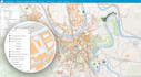
Je ferai de l'analyse spatiale, de la cartographie hydrologique et de la cartographie

I
ijlalfarrukh
I
ijlalfarrukh
Ijlal Farrukh

Level 1

5,0
5,0
Certaines informations ont été traduites automatiquement.

À propos de ce service

Traduction automatique

Avec plus de 6 années d'expérience en SIG, j'apporte une riche connaissance et une grande expertise à la table. Mon parcours éducatif en SIG, associé à une expérience pratique, me permet de relever efficacement une variété de défis liés aux données spatiales. Voici comment je peux vous aider : Services SIG et télédétection - Maîtrise d'ArcGIS et ArcGIS Pro pour le traitement et l'analyse des données - Expertise en techniques de télédétection pour l'interprétation des données - Compétences en manipulation et transformation de données spatiales Tâches que je peux réaliser : 1. Cartographie et cartographie SIG 2. Cartographie hydrologique 3. Ortho-maps 4. Conversion de shapefile 5. Kml vers fichier Excel 6. Création de shapefile 7. Conversion de shapefile 8. Création de géodatabase 9. Analyse géostatistique 10. Analyse spatiale et analyse réseau 11. Création de buffers autour des entités 12. Calcul de distances et construction de modèles 13. Analyse des temps de trajet 14. Analyse hydrologique 15. Analyse de bassin versant 16. Analyse de température 17. Analyse des inondations Prêt à démarrer ? Contactez-moi dès maintenant et discutons de la façon dont je peux vous aider dans vos projets SIG et cartographie !

Découvrez Ijlal Farrukh

Ijlal Farrukh

CREATE, UPDATE, ANALYZE AND MAINTAIN SPATIAL DATA

4,9(15)

Level 1

  • DePakistan
  • Membre depuisjanv. 2021
  • Temps de réponse moy.1 heure
  • Dernière commande2 mois
  • Langues

    Anglais
With 6+ years of GIS experience, I specialize in ESRI tools (ArcGIS Server, GeoServer, ArcGIS Online, ArcGIS Pro) Web mapping, and QGIS. I also offer advanced services in drone LiDAR data processing, photogrammetry, and remote sensing. Whether you need mapping, spatial analysis, or geospatial data visualization, I deliver high-quality results. I have worked with clients from the USA, UK and other countries. I have handled complex software and tools such as #ArcGIS #Cartography #Data Visualization #Spatial analysis #Digitizing #data analyst #geographic information system #google earth

Traduction automatique

Mon portfolio

Avis

1 avis concernant ce service
5,0

(1)
(0)
(0)
(0)
(0)
Détails de la notation
  • Niveau de communication avec le freelance
    5
  • Qualité de la livraison
    5
  • Valeur de la livraison
    5
Trier par
Les plus pertinents
  • B

    brun67castle

    US

    États-Unis

    5

    Best person to work with! I'm not an expert in this area and Ijlal was so kind and understanding. He did such an amazing job on my project and was so thoughtful. I truly appreciate his help and would recommend him to anyone seeking services in his area of expertise. Wonderful experience from beginning to end!

    50 $US

    Prix

    1 jour

    Durée

    Utile?
    Oui
    Non