Parcourir les catégories
Explorer
Fiverr Pro
Français
$
USD

Traduction automatique
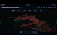
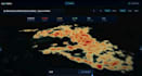
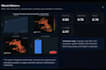
Créer un tableau de bord GIS interactif professionnel avec ArcGIS, QGIS et Google Earth Engine
Vous cherchez un tableau de bord GIS moderne et interactif pour visualiser, analyser et présenter vos données spatiales de manière professionnelle ?
Vous êtes au bon endroit.
Je me spécialise dans le développement de tableaux de bord GIS personnalisés qui transforment des données géospatiales complexes en visualisations claires, interactives et prêtes à la décision. Que votre projet concerne la surveillance environnementale, l’urbanisme, l’agriculture, les services publics, le transport, la recherche ou l’intelligence économique, je peux fournir une solution adaptée à vos besoins.
En utilisant ArcGIS Pro, ArcGIS Online, QGIS, Google Earth Engine et Python, je crée des tableaux de bord de haute qualité, esthétiques, faciles à utiliser et conçus pour soutenir une meilleure prise de décision.
Services que je propose
Tableaux de bord GIS interactifs
Tableaux de bord ArcGIS
Cartographie et géomatique
Analyse de données spatiales
Analyse par télédétection et imagerie satellite
Applications Google Earth Engine
Visualisation GIS web
Analyse de buffer, superposition et réseau
Géoréférencement et numérisation
Conversion de données spatiales (Shapefile, GeoJSON, KML, CSV, GeoPackage)
Cartes personnalisées et visualisation de données
Pourquoi me choisir ?
Expertise en GIS et télédétection professionnelle
GIS Analyst Remote Sensing ArcGIS Pro QGIS GEE
Langues
Traduction automatique
Traduction automatique
De quoi avez-vous besoin pour démarrer mon projet ?
Veuillez fournir vos données spatiales (Shapefile, GeoJSON, CSV, Excel, KML ou GeoPackage), les exigences du projet, le style de tableau de bord préféré et toute fonctionnalité spécifique dont vous avez besoin.
Quel logiciel GIS utilisez-vous ?
Je travaille avec ArcGIS Pro, ArcGIS Online, QGIS, Google Earth Engine et Python pour créer des tableaux de bord GIS professionnels et réaliser des analyses spatiales avancées.
Pouvez-vous créer des tableaux de bord GIS personnalisés ?
Oui. Chaque tableau de bord est conçu spécifiquement selon vos exigences, vos données et vos besoins en visualisation.
Travaillez-vous avec des images satellite ?
Oui. Je peux traiter et analyser des images satellite en utilisant Google Earth Engine et d’autres outils GIS pour la surveillance environnementale, l’analyse de l’utilisation des terres, les indices de végétation, et plus encore.
Dois-je vous contacter avant de passer une commande ?
Oui. Veuillez me contacter avant de passer commande pour que nous discutions de vos besoins et choisissions le package le plus adapté.


