Parcourir les catégories
Explorer
Fiverr Pro
Français
$
USD


Traduction automatique
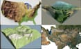
Vous avez du mal à transformer des lignes de contour, des cartes topographiques, des emplacements Google Earth ou des données d'altitude en modèles de terrain 3D précis ? Que vous soyez architecte, ingénieur, géomètre, urbaniste, développeur de jeux, chercheur ou passionné d'impression 3D, je peux vous aider à créer des modèles de terrain précis et de haute qualité adaptés à votre projet.
Je me spécialise dans la transformation de données DEM, lignes de contour, cartes topographiques et données d'altitude du monde réel en modèles de terrain 3D détaillés, optimisés pour la visualisation, les présentations, les simulations, la planification de construction, les projets SIG et l'impression 3D.
Ce que vous recevrez :
Je m'engage à fournir un travail de haute qualité avec une attention particulière aux détails, garantissant que votre modèle de terrain représente fidèlement le paysage réel et répond à vos exigences de projet.
Veuillez me contacter avant de passer commande afin que nous puissions discuter de votre projet, des données et de la taille de la zone
Veuillez informer le freelance de toute préférence ou préoccupation concernant l'utilisation d'outils d'IA dans la réalisation et/ou la livraison de votre commande.
Map Designer
Langues
Traduction automatique
