Parcourir les catégories
Explorer
Fiverr Pro
Français
$
USD

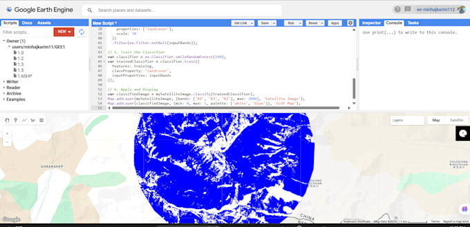
Turning Spatial Data into Smart Insights:GIS and Remote Sensing Expert
Compétences
Voir mes services
Assistant Research Associate
United Nations Development Programme • Temps plein
Jan 2024 - Nov 2024 • 10 mos
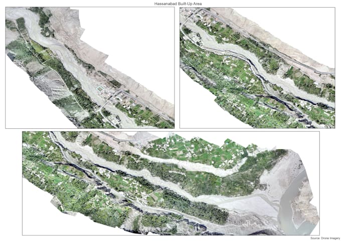
• Recent Land Use/Land Cover (LULC) Classification Utilizing Current Drone Imagery. • Glacial Lake Inventory & Monitoring. • Digitization and Mapping of glaciers and for over 16 sites in Gilgit-Baltistan.
GeoSolutions Lab
Freelancer.com • Temps partiel
Dec 2021 - Nov 2023 • 1 yr 11 mos
·Collected,cleaned, and processed geospatial data from various sources (e.g., shapefiles, raster images, GPS data). ·Digitized maps,scanned documents,and other geospatial information into GIS software. ·Performed basic spatial analysis tasks, such as buffer analysis, overlay analysis,and spatial queries. ·Created thematic maps and other visualizations to communicate spatial information effectively.
