Parcourir les catégories
Explorer
Fiverr Pro
Français
$
USD



Traduction automatique
Je crée des applications WebGIS full-stack qui sont déployées en production, pas des démos ou maquettes.
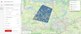
Voici mes réalisations en ligne :
Ce que je construis :
Basique : carte interactive simple avec Leaflet + superposition de données
Standard : WebGIS complet avec Flask + Leaflet et backend PostGIS
Premium : plateforme WebGIS complète avec intégration GEE + déploiement
Contactez-moi avec vos besoins avant de commander.
I am a loyal, hardworking, and responsible individual
Langues
Traduction automatique
Traduction automatique
Quels services GIS proposez-vous ?
Je propose une large gamme de services GIS, incluant l'analyse spatiale, la télédétection, la classification de l'utilisation des sols / couverture du sol, l'analyse de réseau, le développement de modèles GIS personnalisés, la cartographie web interactive et l'évaluation de l'aptitude à un site.
Quel logiciel utilisez-vous pour l’analyse SIG ?
J'utilise ArcGIS Pro, QGIS, Google Earth Engine, ERDAS Imagine, ENVI, ModelBuilder, ArcPy (Python), Leaflet.js et GeoServer pour garantir des résultats précis et professionnels.
Pouvez-vous développer des modèles GIS personnalisés ou automatiser des workflows ?
Oui ! Je peux créer des modèles GIS personnalisés avec ModelBuilder et scripting Python (ArcPy, GDAL) pour automatiser les workflows d'analyse spatiale et améliorer l'efficacité.
Proposez-vous des solutions de cartographie web interactives ?
Oui ! Je propose des évaluations d'aptitude à un site, la planification de l'utilisation des sols, l'analyse du développement urbain et des études d'impact environnemental utilisant des techniques GIS avancées.
Comment démarrer ?
Envoyez-moi simplement un message avec les détails et exigences de votre projet, et je vous guiderai dans les étapes suivantes !


