Parcourir les catégories
Français
$
USD
Connectez votre assistant IA à Fiverr

Level 2
GIS Analyst, Mapping, Spatial Analysis and Data Visualization
Compétences
Voir mes services
Vous souhaitez travailler sur une base horaire ?
Dites à Nadia ce dont vous avez besoin.
12 $US
/
heure
Gis Analyst | Data Visualization expert
Fiverr • Freelance
Sep 2023 - Present • 3 yrs 2 mos
I am working as a GIS Analyst and Data Visualization Expert on Fiverr, providing GIS mapping, spatial analysis, remote sensing, and data visualization services. I have over 4 years of experience using ArcGIS Pro, ArcMap, QGIS, and Google Earth Pro to create accurate maps, analyze spatial data, and turn complex information into clear and meaningful visuals. I work with clients on projects related to land use, environmental management, urban planning, and agriculture.
Gis Analyst
theinnoventures.pvt.ltd • Temps plein
Dec 2023 - Sep 2024 • 9 mos
I worked as a GIS Analyst at Innoventures Pvt. Ltd., where I gained practical experience in Geographic Information Systems (GIS) and Remote Sensing (RS). During my time there, I worked on different GIS-based projects that involved analyzing spatial data, creating maps, and processing satellite imagery. I used GIS software such as QGIS to organize and visualize geographic data and support different types of analysis. Through this experience, I improved my skills in spatial data management, map creation, and satellite image interpretation. It also helped me understand how GIS can be used to solve real-world problems and support better decision-making in areas such as environmental analysis, planning, and mapping
| (20) | ||
| (3) | ||
| (0) | ||
| (1) | ||
| (2) |
ken96734

États-Unis
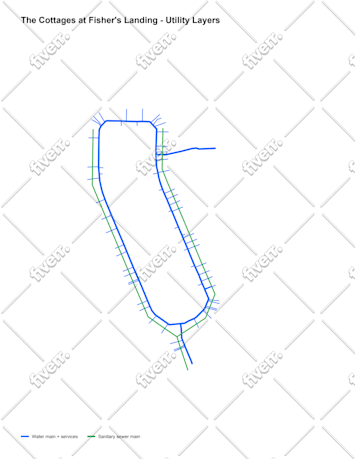
Nadia was doing a very good job of working with poor documents from me and was able to make it into the working documents i need
ken96734
États-Unis
Nadia did a great job as always
ken96734
États-Unis
sandrawagner106
États-Unis
very good job, professional and competent.
ivvvanguetler

Suisse