Certaines informations sont présentées en anglais.
À propos de moi
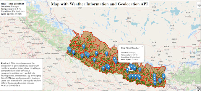
Hi! I am a GIS and Remote Sensing analyst with skills in mapping, satellite image analysis, and data processing. I use tools like QGIS, ArcGIS, Google Earth Engine, ENVI, Python, and Excel to provide clear and useful results.
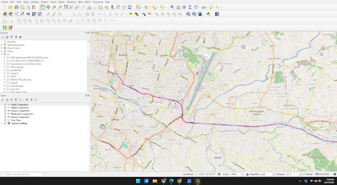
I have worked on projects such as forest change studies, air pollution estimation, groundwater mapping, waste site analysis, and traffic congestion mapping.
If you need maps, data analysis, or research support, I will deliver accurate, reliable, and on-time work.... Plus d’infos