Parcourir les catégories
Explorer
Fiverr Pro
Français
$
USD

commande 1 en file d'attente


_tlztyb.jpg)
_cqsnae.jpg)

Traduction automatique
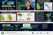
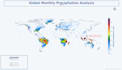
Vous avez besoin de cartes GIS précises et professionnelles pour votre projet, rapport ou recherche ? Vous êtes au bon endroit.
Fort de plus de 6 ans d’expérience en tant que responsable GIS et ingénieur en environnement, je réalise des cartes de qualité publication et des analyses spatiales avec ArcGIS Pro et QGIS.
Ce que je propose :
Pourquoi mes clients me choisissent :
Outils : ArcGIS Pro, QGIS, Google Earth Engine, ERDAS, Python, PostGIS
Contactez-moi avant de commander pour que je puisse confirmer que votre projet correspond parfaitement à mes compétences.
GIS and Spatial Analysis Expert, Maps, Remote Sensing and Data Visualization
Langues
Traduction automatique
Traduction automatique
Dans quels types de projets GIS vous spécialisez-vous ?
Agriculture, conseil environnemental, extraction minière et urbanisme. Je gère tout, des cartes simples aux flux de travail géospatiaux complets — traitement satellite, modélisation spatiale, livraison de géodatabase et rapport technique.
Quels outils et logiciels utilisez-vous ?
ArcGIS Pro, QGIS, Google Earth Engine, ERDAS Imagine, Python (GeoPandas, Rasterio, GDAL, PyTorch), PostGIS et Power BI — sélectionnés en fonction de l’échelle de votre projet, du format des données et des exigences de livraison.
Quelles méthodologies appliquez-vous ?
FAO-56 ETc, érosion RUSLE, aptitude MCDA, santé des cultures NDVI/EVI, modélisation des inondations (HAND/DEM), empreinte hydrique (Pfister et al./ISO 14046), classification ML (PyTorch) et détection de changements multi-temporels.
Avec quels formats de données pouvez-vous travailler ?
Entrées : shapefile, GeoTIFF, GeoPackage, KML, CSV, NetCDF, images Sentinel/Landsat. Sorties : cartes PDF, GeoTIFF, GeoPackage, File Geodatabase, rasters classifiés, rapport technique et scripts Python sur demande.
Pouvez-vous automatiser des tâches SIG avec Python ?
Oui. Je crée des pipelines automatisés avec GeoPandas, Rasterio, GDAL et l’API Python de GEE — reprojection par lot, statistiques zonales, séries temporelles NDVI et traitement d’attributs personnalisé. Idéal pour de grands ensembles de données ou des processus récurrents.
Supportez-vous des projets académiques et de recherche ?
Oui. Je possède un article de recherche géologique publié et je propose un accompagnement pour les thèses, l’exécution de recherches et la rédaction de rapports techniques citant les normes ISO 14046, FAO-56 et IPCC. Tous les résultats sont originaux et entièrement traçables.
Comment savoir quel forfait me convient ?
Basique : une carte ciblée. Standard : analyse multi-couches + géodatabase + rapport. Premium : flux de travail complet — télédétection, modélisation, géodatabase et rapport technique. Contactez-moi pour confirmer la formule la mieux adaptée.
Quelles informations dois-je fournir ?
Zone d’étude, données disponibles, usage final (rapport/reglementation/publication), format de sortie préféré, système de référence de coordonnées (CRS) et délai. Pas encore de données ? Je peux vous conseiller sur la recherche et la définition du périmètre avant votre commande.
| (4) | ||
| (1) | ||
| (0) | ||
| (0) | ||
| (0) |
mila_m2006

États-Unis
great profesional
50 $US-100 $US
Prix
11 jours
Durée

Réponse du freelance

shanantana

Nouvelle-Zélande
I fully recommend Joonava, she provided an excellent service and went above and beyond exceeding our expectations. She was a pleasure to work with and we will be working with her again.
50 $US
Prix
13 jours
Durée
mireillebellemb

France
A great experience, Joonava is very dynamic and a good listener. I recommend her!
50 $US
Prix
4 jours
Durée
Réponse du freelance
mireillebellemb
France
Dear member, I appreciated Joonava's attentiveness, responsiveness and professionalism. In short, I recommend her. Kind regards
50 $US
Prix
1 jour
Durée
jawan002

Sri Lanka
Working with Joo was an absolute pleasure from start to finish. From our initial communication, it was clear that she is incredibly talented and highly committed to client satisfaction. She was punctual in delivering the completed land classification map actually she delivered the map two days before...
50 $US
Prix
2 jours
Durée

| (4) | ||
| (1) | ||
| (0) | ||
| (0) | ||
| (0) |
mila_m2006
États-Unis
great profesional
50 $US-100 $US
Prix
11 jours
Durée
Réponse du freelance
shanantana
Nouvelle-Zélande
I fully recommend Joonava, she provided an excellent service and went above and beyond exceeding our expectations. She was a pleasure to work with and we will be working with her again.
50 $US
Prix
13 jours
Durée
mireillebellemb
France
A great experience, Joonava is very dynamic and a good listener. I recommend her!
50 $US
Prix
4 jours
Durée
Réponse du freelance
mireillebellemb
France
Dear member, I appreciated Joonava's attentiveness, responsiveness and professionalism. In short, I recommend her. Kind regards
50 $US
Prix
1 jour
Durée
jawan002
Sri Lanka
Working with Joo was an absolute pleasure from start to finish. From our initial communication, it was clear that she is incredibly talented and highly committed to client satisfaction. She was punctual in delivering the completed land classification map actually she delivered the map two days before...
50 $US
Prix
2 jours
Durée


