Je vais numériser les images satellite des feuilles topographiques dans arcgis

N
nomi_solutions
N
nomi_solutions
Nouman Ijaz

Level 1

Certaines informations ont été traduites automatiquement.

À propos de ce service

Traduction automatique

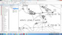
Bienvenue à mon service je numériserai des feuilles topographiques, des images satellites ou d'autres images/cartes dans Arcgis
je vais

  • Géoréférence
  • Numérisez vos données raster pour les convertir au format vectoriel
  • soumettra le fichier vectoriel dans les formats suivants : shapefiles, Geodatabase, Kml, Kmz, Eps, Ai, etc.
  • Créer une carte professionnelle claire

je travaillerai pour vous fournir une satisfaction à 100%

Le prix est négociable

Avant de passer une commande, envoyez-moi un message !
Merci
Meilleurs vœux!!!
Noms
Découvrez Nouman Ijaz

Nouman Ijaz

GIS Specialist and Google Earth Expert

4,4(233)

Level 1

  • DePakistan
  • Membre depuisdéc. 2016
  • Temps de réponse moy.1 heure
  • Dernière commande1 jour
  • Langues

    Anglais
Hello, I am Nouman Ijaz, a professional GIS Analyst with several years of experience in GIS and RS. I specialize in transforming spatial data into accurate, meaningful, and visually clear maps and geospatial. I have worked on a wide range of GIS projects involving mapping, spatial analysis, satellite imagery processing, and geospatial data management for business, environmental, and planning purposes. I am highly skilled in industry-standard tools such as ArcGIS, QGIS, Google Earth Pro, and Google Earth Studio, and I use these tools to deliver high-quality geospatial solutions.

Traduction automatique

Mon portfolio