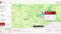
Je vais créer des cartes GIS, analyse spatiale et tableaux de bord de données

P
peterboateng06
P
peterboateng06
PETER BOATENG
Certaines informations ont été traduites automatiquement.

À propos de ce service

Traduction automatique

Envoyez-moi vos données de localisation, données de terrain ou besoins en images satellites, et je les transformerai en cartes GIS propres, analyses spatiales ou visuels de télédétection que vous pourrez utiliser pour des rapports, présentations, recherches ou planifications.

Découvrez PETER BOATENG

PETER BOATENG

GIS Mapping, Spatial Data and Dashboard Specialist

  • DeGhana
  • Membre depuisaoût 2021
  • Langues

    Anglais
I help clients turn messy location and programme data into clear maps, dashboards and reports. I work with QGIS, ArcGIS Pro, Google Earth Engine, KoBoToolbox, Excel, MapLibre and Chart.js. My work covers GIS mapping, spatial analysis, remote sensing, data cleaning, field data forms, web maps and evidence packs. I have supported projects in public health, urban planning, transport safety, environmental risk and donor-funded programme delivery. Clear data, clean visuals and reliable communication are what I focus on.

Traduction automatique

Mon portfolio