Parcourir les catégories
Français
$
USD
Connectez votre assistant IA à Fiverr

Traduction automatique
Vous avez besoin d’un ingénieur en géo-informatique expert pour créer des applications Web GIS puissantes, des cartes interactives avec des visualisations en 2D et 3D
Je suis diplômé en géo-informatique avec 10 ans d’expérience, spécialisé en programmation GIS, analyse de données spatiales et développement à l’échelle de l’entreprise. Que vous ayez besoin d’un tableau de bord GIS dynamique, d’un plugin QGIS personnalisé ou de solutions GIS évolutives pour l’entreprise.
Services principaux :
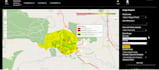
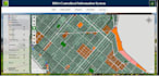
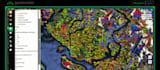
Applications WebGIS : Développements full-stack avec GeoDjango, Node.js et React.
Cartes interactives : Cartographie responsive et interactive sur mesure via Leaflet, Mapbox, Maplibre et Folium.
Visualisation 3DGIS : Solutions spatiales immersives avec Cesium et Three.js.
Bases de données spatiales : Requêtes avancées et gestion avec PostGIS et PostgreSQL.
Automatisation et plugins : Développement de plugins QGIS sur mesure et programmation GIS en Python.
Data science : Traitement de données spatiales avec GeoPandas, Rasterio et Sklearn.
Pourquoi me choisir ?
Plus de 10 ans d’expérience en ingénierie GIS, fournissant un code propre et évolutif, de l’architecture de la base de données à la conception de l’interface utilisateur et aux cartographies interactives axées sur l’information.
️ NOTE : Veuillez m’envoyer un message AVANT de passer commande pour discuter de vos fichiers de données et de votre projet.
GeoInformatics Specialist and Environmental Data Analyst
Langues
Traduction automatique
Traduction automatique
Que dois-je fournir avant de passer une commande ?
Veuillez fournir vos exigences de projet, objectifs cibles et tous les fichiers de données spatiales existants (tels que Shapefiles, GeoJSON, KML ou coordonnées CSV). Si vous avez besoin d’une application Web GIS d’entreprise ou d’une intégration de base de données, partager votre stack technologique préférée (par exemple, Django, React, PostGIS) est fortement recommandé.
Dans quelles bibliothèques de cartographie et frameworks web vous spécialisez-vous ?
Je crée des applications Web GIS personnalisées en utilisant des frameworks modernes comme Django (GeoDjango), Node.js et React. Pour les cartes interactives en frontend, je me spécialise en Leaflet js, Mapbox, Folium et OpenLayers, ainsi qu’en Cesium et Three.js pour des visualisations immersives de données GIS en 3D.
Pouvez-vous gérer la gestion de bases de données spatiales et les tâches de géoprocessing ?
Absolument. J’ai une expertise approfondie dans la création, l’optimisation et la gestion de bases de données spatiales relationnelles avec PostGIS et PostgreSQL. Je réalise des requêtes SQL spatiales complexes, la conception de bases de données et des pipelines de géoprocessing automatisés en backend avec des bibliothèques Python comme GeoPandas.
Allez-vous héberger ou déployer la carte web interactive ou l’application terminée ?
Je fournirai le code source propre, entièrement documenté, prêt pour le déploiement. Si nécessaire, je peux également vous aider à déployer votre application Web GIS sur des plateformes d’hébergement comme GitHub Pages, Netlify, AWS ou votre environnement serveur local en tant que service supplémentaire.
Développez-vous des outils GIS de bureau personnalisés ou des plugins QGIS ?
Oui, je propose des services de programmation GIS sur mesure. Je peux écrire des scripts Python autonomes pour l’analyse automatisée de données spatiales ou développer des plugins QGIS entièrement fonctionnels et adaptés pour optimiser et accélérer votre flux de travail de bureau spécifique.


