r
rafiferison

Erison

@rafiferison
5,0(1)

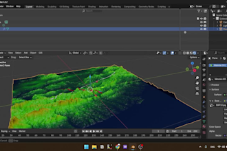
Precision GIS Solutions for Your Spatial Needs

Indonésie
Anglais, Indonésien
Certaines informations sont présentées en anglais.
À propos de moi
🌍 Geodetic Engineer | GIS Analyst | Topographic Survey Supervisor Hi! I'm Muhammad Rafif Erison, a passionate Geodetic Engineer with over 3 years of experience in spatial data analysis and topographic surveying. Currently, I serve as the Survey Supervisor at the Jakarta Public Works and Spatial Planning Agency, leading the Topography Measurement Unit. 📌 I specialize in GIS Analysis, blending precision, technical know-how, and aesthetic map design. Whether you need clean spatial data processing or insightful map visualization, I’m ready to help you turn data into actionable insights.... Plus d’infos

Compétences

r
rafiferison
Erison
hors ligne • 
Temps de réponse moyen de 1 heure

Voir mes services

Système d'information géographique (SIG)
I will provide detailed gis mapping and spatial data analysis
5,0(1)
Système d'information géographique (SIG)
I will deliver high accuracy coordinates from your gnss survey data

Portfolio

Expérience professionnelle

Hydrographic Surveyor

PAGEO UTAMA • Temps plein

Jun 2025 - Present11 mos

- BMS TMS Positioning - Nearshore Survey - USBL Positioning

1 Avis
5,0

(1)
(0)
(0)
(0)
(0)
Détails de la notation
  • Niveau de communication avec le freelance
    5
  • Qualité de la livraison
    5
  • Valeur de la livraison
    5
1 à 1 avis sur 1
Trier par
Les plus pertinents
    A

    annalandis

    US

    États-Unis

    5

    Erison was outstandingly professional, diligent, timely, and understanding. I had a difficult request and Erison made sure we talked through what I was asking for, submitted many questions to be thorough, and allowed me to be a part of achieving the end result. I can’t recommend Erison enough! My project...

    50 $US-100 $US

    Prix

    2 jours

    Durée

    gig

    Système d'information géographique (SIG)

    Utile?
    Oui
    Non