Parcourir les catégories
Explorer
Fiverr Pro
Français
$
USD


Traduction automatique
Bienvenue dans mon service de cartographie par drone thermique !
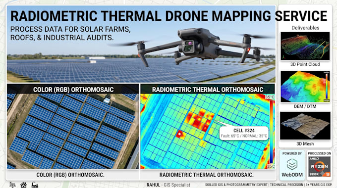
Je suis un spécialiste SIG offrant un traitement de données thermiques drone de haute qualité. Grâce à une station de traitement avancée à 16 cœurs et WebODM, je assemble avec précision vos images thermiques brutes en cartes nettes et riches en données pour l’inspection de panneaux solaires, les audits de perte de chaleur des toits et les relevés industriels.
Les livrables incluent :
Veuillez m’envoyer un message avant de passer commande pour confirmer la taille de votre jeu de données et vous assurer que vos images contiennent des métadonnées radiométriques !
Fiverr ne filtre pas les freelances dans cette catégorie. Veuillez vérifier les qualifications et discuter des critères avec le freelance avant de passer commande, y compris toute préférence concernant l'utilisation d'outils d'IA.
GIS Specialist, Drone Photogrammetry Expert
Langues
Traduction automatique
