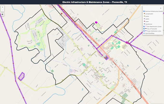
Je fournirai une cartographie SIG professionnelle et une analyse spatiale

R
rudy_fasanogis
R
rudy_fasanogis
Rudy F
Certaines informations ont été traduites automatiquement.

À propos de ce service

Traduction automatique

Je fournirai des services professionnels de cartographie SIG et d’analyse spatiale en utilisant QGIS, Python et d’autres outils géospatiaux. Je peux créer des cartes personnalisées, analyser des données spatiales, effectuer le nettoyage et le traitement des données, et livrer des produits SIG précis et de qualité professionnelle adaptés à vos besoins.

Découvrez Rudy F

Rudy F

GIS and Remote Sensing Specialist

  • DeÉtats-Unis
  • Membre depuisjuil. 2026
  • Langues

    Anglais, Portugais, Italien, Espagnol
I’m a GIS professional with 5+ years of experience in GIS, remote sensing, spatial analysis, and geospatial data. I work with ArcGIS Pro, QGIS, Python, EO and SAR imagery. My experience includes mapping, data analysis, automation, change and object detection, and natural disaster analysis, including wildfire, burn severity, and flood assessment. I’ll focus on understanding your needs and delivering accurate results that are practical and useful to you!

Traduction automatique