s
sandeepgautam10

Sandeep

@sandeepgautam10
4,7(2)

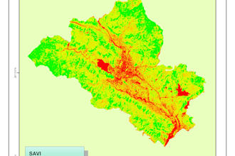
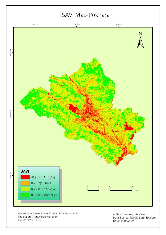
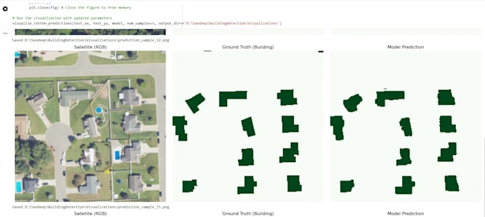
GIS and Remote Sensing Expert

Népal
Anglais, Hindi, Népalais
Certaines informations sont présentées en anglais.
À propos de moi
I help you get accurate, clean, and ready-to-use GIS data. I am a Geomatics Engineer experienced in QGIS, ArcGIS, satellite imagery, UAV & LiDAR processing. I specialize in digitization, spatial analysis, QA/QC, and large-scale mapping projects for international clients. I also use GeoAI (U-Net, YOLO) to automate feature extraction. Expect high accuracy, fast delivery, and professional results every time.... Plus d’infos

Compétences

s
sandeepgautam10
Sandeep
hors ligne • 
Temps de réponse moyen de 1 heure

Voir mes services

Système d'information géographique (SIG)
I will perform remote sensing analysis in gee, arcgis or python
4,7(2)
Deep learning
I will apply deep learning in satellite imagery for segmentation and object detection

Portfolio

2 Avis
4,7

(1)
(1)
(0)
(0)
(0)
Détails de la notation
  • Niveau de communication avec le freelance
    4,5
  • Qualité de la livraison
    5
  • Valeur de la livraison
    4,5
1 à 2 avis sur 2
Trier par
Les plus pertinents
    E
    image-docs

    elwinvanalst

    NL

    Pays-Bas

    4,3

    Sandeep took the time to work on a custom order for me. I really appreciated his extra time and effort to workout a custom height map for my project.

    Jusqu’à 50 $US

    Prix

    1 jour

    Durée

    gig

    Système d'information géographique (SIG)

    Utile?
    Oui
    Non
    R

    ron_guetta

    DE

    Allemagne

    5

    it was fantastic working with. he gave is heart and attention to the project

    50 $US-100 $US

    Prix

    1 jour

    Durée

    gig

    Système d'information géographique (SIG)

    Utile?
    Oui
    Non