Land surveying i Land Development I Walkthrough I Scan to BIM I Point cloud
Inde
Anglais
Certaines informations sont présentées en anglais.
À propos de moi
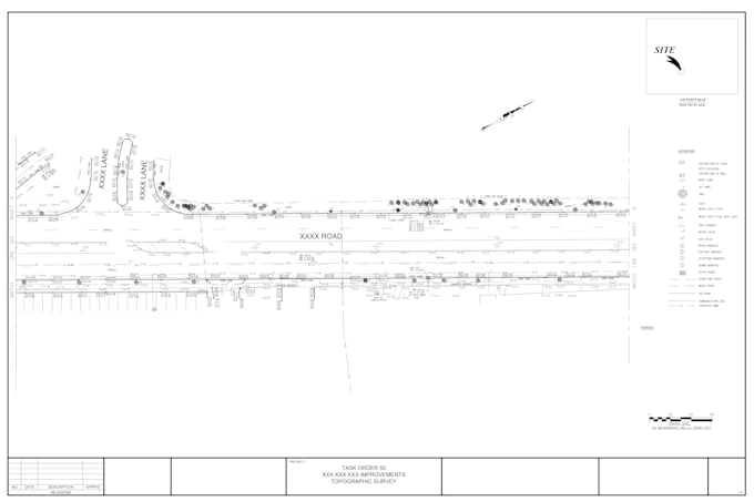
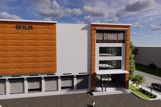
Land Surveying, Civil Engineering & Architectural Services:
I provide land surveying services including boundary, topographic, as-built, lot, and UAV (drone) surveys. I deliver civil design and CAD drafting using AutoCAD and Civil 3D for land development projects, covering site layouts, grading, earthwork, road profiles, drainage, utilities, and erosion control. I also prepare architectural permit drawing sets with architectural, structural, and civil coordination, as well as 3D modeling, renderings, walkthroughs, and point cloud–based documentation.... Plus d’infos