Parcourir les catégories
Explorer
Fiverr Pro
Français
$
USD

Level 1


Hello!
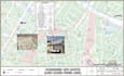
I'm a seasoned GIS & Illustrator expert with over 11+ years of experience in providing top-notch solutions. I specialize in data visualization, creating demographic maps, choropleth maps, thematic maps, heat maps, and density maps.
I specialize in Utilities Network & GIS Mapping Services, offering:
- Digitization & Geo-referencing
- Data Conversion (CAD, Excel, Shapefile, KML, etc.)
- Network Analysis & Geo-spatial Analysis
- Mapping Services (Landuse, Basemap, Topographic)
- Geocoding, LIDAR, DEM & TIN analysis
Let me help with your utility network and GIS mapping needs!
I'm proficient in a range of software, including ArcGIS, ArcGIS Pro, Adobe Illustrator, Power BI, Google Earth Pro, QGIS, Bentley, MS Office, Mapbox, Cesium, SAP and ERDAS Imagine.
Whether you need help with a research project or any GIS-related task, I'm here to assist you. I'll deliver the best visualization of your data and ensure that your project meets your expectations.
Feel free to get in touch with me before placing an order, and I'll be happy to discuss your project in more detail.
Thank you!
SK
Precision, Dedication, and Expertise : The SK's mantra !!!
Level 1
Langues
| (2) | ||
| (0) | ||
| (0) | ||
| (0) | ||
| (0) |
afalamry

Arabie Saoudite
S K did an outstanding job with data visualization, showing remarkable PROFESSIONALISM and ATTENTION to detail. Always POLITE and efficient with delivery time, they exceeded my expectations in every aspect. The work was PERFECT – thank you very much, I'm happy to deal with you again! 🙌
100 $US-200 $US
Prix
5 jours
Durée

zneu_dev

États-Unis
Really great working together. Happy to do work again in the future.
50 $US-100 $US
Prix
3 semaines
Durée
| (2) | ||
| (0) | ||
| (0) | ||
| (0) | ||
| (0) |
afalamry
Arabie Saoudite
S K did an outstanding job with data visualization, showing remarkable PROFESSIONALISM and ATTENTION to detail. Always POLITE and efficient with delivery time, they exceeded my expectations in every aspect. The work was PERFECT – thank you very much, I'm happy to deal with you again! 🙌
100 $US-200 $US
Prix
5 jours
Durée
zneu_dev
États-Unis
Really great working together. Happy to do work again in the future.
50 $US-100 $US
Prix
3 semaines
Durée


