Parcourir les catégories
Explorer
Fiverr Pro
Français
$
USD


Traduction automatique
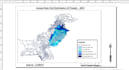
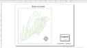
Je créerai des cartes GIS professionnelles en utilisant ArcGIS et QGIS. Je peux réaliser des cartes thématiques, des cartes NDVI, des cartes LULC, des cartes des sols, de la numérisation et des analyses GIS de base.
GIS and Remote Sensing Student
Langues
Traduction automatique
Traduction automatique
Quels logiciels GIS utilisez-vous ? J’utilise ArcGIS et QGIS pour la cartographie et l’analyse GIS.
2. Quel type de cartes pouvez-vous créer ? Je peux réaliser des cartes thématiques, NDVI, LULC, des cartes des sols et d’autres cartes basées sur GIS.


