Parcourir les catégories
Explorer
Fiverr Pro
Français
$
USD







Traduction automatique
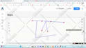
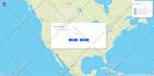
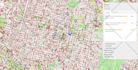
Vous cherchez un expert GIS fiable pour transformer vos données spatiales en solutions précises, interactives et évolutives ?
Je suis ingénieur et développeur GIS avec plus de 10 ans d’expérience dans la création d’applications géospatiales web, desktop, bases de données et basées sur les données. Je travaille avec Esri ArcGIS, QGIS, Google Maps, Mapbox, Leaflet, Python, GDAL, GeoPandas, PostGIS, SQL Server, Node.js, Django et FastAPI.
Mes services incluent :
Je fournis des solutions propres, évolutives, avec une communication claire et une attention particulière aux détails. Que vous ayez besoin d’un proof of concept, d’un produit GIS personnalisé, d’automatisation ou d’améliorations pour une application existante, je suis prêt à vous aider.
Veuillez me contacter avant de commander pour discuter de vos besoins.
GIS Developer, GIS Specialist, Map Expert, Geospatial Engineer
Langues
Traduction automatique
Traduction automatique
De quelles informations avez-vous besoin pour commencer ?
Veuillez fournir les fonctionnalités requises, les données d'exemple, la plateforme de cartographie préférée, les références de conception et l'environnement de déploiement attendu.
Pouvez-vous travailler avec mon site web ou application existante ?
Oui. Je peux intégrer une carte Web GIS dans une application existante ou développer une solution autonome.
Quels formats géospatiaux supportez-vous ?
Je travaille avec GeoJSON, Shapefile, GeoPackage, KML, CSV, tuiles raster, tuiles vectorielles, PostGIS et APIs REST.
Vais-je recevoir le code source ?
Oui, la livraison du code source peut être incluse en fonction du package choisi ou de l'offre personnalisée.
Pouvez-vous intégrer des APIs et des bases de données spatiales ?
Oui. Je peux intégrer des APIs tierces, PostGIS, SQL Server, GeoServer et des services backend personnalisés.
Fournissez-vous un support de déploiement ?
Oui. Le déploiement peut être inclus dans le périmètre du projet ou acheté en tant que service supplémentaire.
Pouvez-vous ajouter une connexion, des rôles et un accès sécurisé aux données ?
Oui. Je peux mettre en place l'authentification, les rôles utilisateur, des APIs protégées et un accès contrôlé aux données spatiales.
| (172) | ||
| (3) | ||
| (0) | ||
| (0) | ||
| (1) |

mattabedin

États-Unis
Best GIS team you could ever find. Excellent work.
1 000 $US-2 500 $US
Prix
2 semaines
Durée

Réponse du freelance
mattabedin
États-Unis
Excellent work, highly recommended.
200 $US-400 $US
Prix
4 semaines
Durée

mellodeveloper

Royaume-Uni
Great collaboration with Ali, he was able to create our GIS tool with our requirements.
2 500 $US-5 000 $US
Prix
2 Mois
Durée
mellodeveloper
Royaume-Uni
It was great to work with Ali. He undertood the project and gave us a lot of inputs to solve the solution. I will work with him in future projects.
1 000 $US-2 500 $US
Prix
3 semaines
Durée

Réponse du freelance
mellodeveloper
Royaume-Uni
It was great to work with Ali. He undertood the project and gave us a lot of inputs to solve the solution. I will work with him in future projects.
1 000 $US-2 500 $US
Prix
3 semaines
Durée

Réponse du freelance
| (172) | ||
| (3) | ||
| (0) | ||
| (0) | ||
| (1) |
mattabedin
États-Unis
Best GIS team you could ever find. Excellent work.
1 000 $US-2 500 $US
Prix
2 semaines
Durée
Réponse du freelance
mattabedin
États-Unis
Excellent work, highly recommended.
200 $US-400 $US
Prix
4 semaines
Durée
mellodeveloper
Royaume-Uni
Great collaboration with Ali, he was able to create our GIS tool with our requirements.
2 500 $US-5 000 $US
Prix
2 Mois
Durée
mellodeveloper
Royaume-Uni
It was great to work with Ali. He undertood the project and gave us a lot of inputs to solve the solution. I will work with him in future projects.
1 000 $US-2 500 $US
Prix
3 semaines
Durée
Réponse du freelance
mellodeveloper
Royaume-Uni
It was great to work with Ali. He undertood the project and gave us a lot of inputs to solve the solution. I will work with him in future projects.
1 000 $US-2 500 $US
Prix
3 semaines
Durée
Réponse du freelance


