Je vais résoudre vos problèmes géospatiaux efficacement

S
sunbeamrahman
S
sunbeamrahman
Sunbeam R
5,0
5,0
Certaines informations ont été traduites automatiquement.

À propos de ce service

Traduction automatique

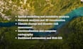
Obtenez de l’aide pour la modélisation spatiale, l’analyse de la pertinence, la cartographie des émissions, l’analyse de réseau, l’évaluation de l’impact climatique, la cartographie et d’autres sujets similaires.


Je suis un expert en analyse spatiale, télédétection et cartographie, avec plus de 12 ans d’expérience basé à Calgary. Je possède un MGIS de l’Université de Calgary, Alberta, ainsi qu’un MSc en géographie.


J’ai une vaste expérience dans des sujets, notamment (mais pas exclusivement)

  • Télédétection avancée : traitement de données multispectrales/hyperspectrales/radar/nuages de points pour les écosystèmes forestiers, agricoles, humides et urbains en utilisant des environnements de bureau (par exemple, ArcGIS, Erdas Imagine, eCognition, etc.) et des environnements cloud (par exemple, GEE)
  • Scriptage spatial : Python (ArcPY, GeoPandas, Rasterio, Xarray, etc.), R (sf, tidyverse), et Google Earth Engine
  • SIG d’entreprise, automatisation de tableaux de bord et SIG Web : Esri ArcGIS Enterprise (gestion d’ArcGIS Server et Portal, Survey123), AGOL, Experience builder
  • Rédaction technique : rapports techniques, manuels, blogs et tutoriels.


Pourquoi devriez-vous m’embaucher ?

  • Observations expérimentées et livraison rapide
  • Retour d’information rapide et support adapté à chaque client
  • Forfaits de travail personnalisés et consultation


Veuillez discuter avant de commander.

Découvrez Sunbeam R

Sunbeam R

Geospatial wizardry: analyze, code, export, repeat!

5,0(47)
  • DeCanada
  • Membre depuisjuil. 2020
  • Temps de réponse moy.1 heure
  • Dernière commande1 an
  • Langues

    Français, Anglais
With over 10 years of experience in remote sensing, spatial analysis, and geospatial project coordination, I hold a Master's in Geography, an MGIS degree, and a CAPM® certification. I specialize in applying GIS to address complex challenges in urban geography, environmental monitoring, and climate change modelling. I am skilled in: ✅ Geospatial analysis, cartography, remote sensing, and photogrammetry ✅ Spatial automation and modeling using Python, R, and cloud platforms ✅ ArcGIS Enterprise, EGDB management, and multi-user GIS environments. My portfolio - rahmansunbeam.github.io

Traduction automatique

Mon portfolio

Avis

2 avis concernant ce service
5,0

(2)
(0)
(0)
(0)
(0)
Détails de la notation
  • Niveau de communication avec le freelance
    5
  • À recommander à un ami
    5
  • Service conforme à la description
    5
  • Qualité de la livraison
    5
Trier par
Les plus pertinents
  • K

    kushu1940

    Client récurrent

    GB

    Royaume-Uni

    5

    Very proactive and helpful

    Jusqu’à 50 $US

    Prix

    4 jours

    Durée

    Utile?
    Oui
    Non
  • K

    kushu1940

    Client récurrent

    GB

    Royaume-Uni

    5

    Very prompt and so helpul

    Jusqu’à 50 $US

    Prix

    4 jours

    Durée

    Utile?
    Oui
    Non
Avis

2 avis concernant ce service
5,0

(2)
(0)
(0)
(0)
(0)
Détails de la notation
  • Niveau de communication avec le freelance
    5
  • À recommander à un ami
    5
  • Service conforme à la description
    5
  • Qualité de la livraison
    5
Trier par
Les plus pertinents
  • K

    kushu1940

    Client récurrent

    GB

    Royaume-Uni

    5

    Very proactive and helpful

    Jusqu’à 50 $US

    Prix

    4 jours

    Durée

    Utile?
    Oui
    Non
  • K

    kushu1940

    Client récurrent

    GB

    Royaume-Uni

    5

    Very prompt and so helpul

    Jusqu’à 50 $US

    Prix

    4 jours

    Durée

    Utile?
    Oui
    Non