Certaines informations sont présentées en anglais.
À propos de moi
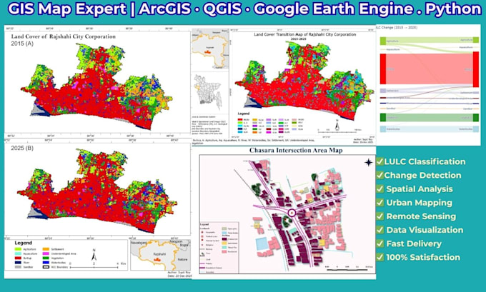
Hi! I'm Supti Roy, an Urban Planner and GIS & Remote Sensing specialist with hands-on experience in spatial data analysis, satellite imagery processing, and land use mapping.
I work with:
ArcGIS Pro, ArcMap, QGIS, Google Earth Engine,
eCognition,
Python, R (RStudio), IBM SPSS
AutoCAD, SketchUp
KoboToolbox, Survey123
I have real project experience in LULC classification, change detection, waterbody mapping, drone imagery processing, and thematic map production.
If you need accurate, professional GIS or remote sensing work — I deliver on time, every time.... Plus d’infos