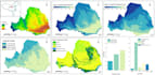
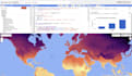
Expert professionnel en Google Earth Engine (GEE) fournissant des services de données satellites et d'analyse. Livraison rapide, résultats propres, et code complet inclus pour des projets académiques et commerciaux.
1️ BASIQUE : Téléchargement de données (30 $)
- Télécharger des indices clés (NDVI, NDWI, NDBI) ou des images brutes
- Jusqu'à 5 ans de données pour votre région
- Fichiers GeoTIFF/CSV masqués par le cloud, prêts pour l'analyse
- Résumé rapide des données
- Livraison : 2 jours | Révisions : 1
2️ STANDARD : Données + Analyse (50 $)
- Tout dans la formule Basic PLUS
- Graphiques de séries temporelles et cartes de tendance
- Visualisations personnalisées pour rapports
- Résumé statistique
- Livraison : 3 jours | Révisions : 2
3️ PREMIUM : Solutions complètes pour projet (150 $)
- Tout dans la formule Standard PLUS
- Classification supervisée, détection de changement, apprentissage profond
- Code GEE complet et réutilisable (JavaScript/Python)
- Notes méthodologiques détaillées
- Période de temps illimitée
- Livraison : 7 jours | Révisions : 3
Pour commencer, fournissez :
- Votre zone d'intérêt (coordonnées/shapefile)
- Période de temps souhaitée
- Données ou analyses spécifiques requises
- Votre package choisi